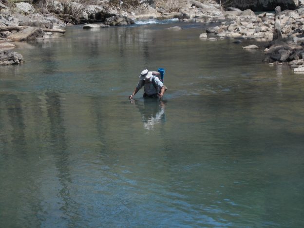
Easy hike over a couple of days.
Backpackers: Carl Fisher and Ed Tucker
April 20, 2014 – Ed picked me up at Megan’s house on Easter. We drive to Springfield, IL and get a motel room.
April 21, 2014 – We hit the road at 8:00AM. Since
we were ahead of schedule we stopped to do 2 different wine tastings in
Missouri. The first was at OOVVDA Winery in Springfield, MO
where the gentleman conducting the tasting was also the grower of many
of the fruits used to make the wine and he was also the wine maker. The
wine was mainly made using fruits with different levels of sweetness.
None were really good but I bought a bottle to support a local
business. The second winery was in Carthage, MO – the White Rose Winery.
Just like the first winery the wine maker was doing the wine tasting.
Neither Ed nor I liked any of the wines so we didn’t buy any. We
arrived at the hotel for the G60 contest at 4:30 where Jeff, Phil,
Janie, Beth and Brett Amerine were already there getting set up. It was
an excellent competition and we spent the night at Jeff’s house in
Farmington, AR.
April 22, 2104 – Departed at
7:30AM for Richland Creek Campground, AR – the jumping off point for the
hike. We got there a little before noon and hit the trail at 11:55AM.
After hiking for about 5 minutes we had to remove boots, put on water
shoes, and cross Richland Creek. The water was up to my crotch but
weather was warm so no problem. Easy hiking with some up and down and
some along the creek bottom littered with stone. About 2.5 miles into
the hike we again did a water crossing of Richland Creek which was a few
inches deeper than the previous one. Another mile or so up the trial
we arrived at Twin Falls at Richland Creek (there are more than one
“Twin Falls” in Arkansas). After skirting around the falls we crossed
Long Devil’s Fork Creek by rock hopping, stopped and filled up with
water, and then began a steady uphill climb for a mile or so to arrive
at Sandstone Castles. The “castles” are a maze of tunnels and grottos
riddling the sandstone bluffs. Legend has it that outlaws and Civil War
deserters holed up here. Our two single person tents fit nicely into
one of the “castles”. We saw no one the entire day.
April 23, 2014
– During the night some sort of winged animal flew around the cave. I
heard a whoop, whoop, whoop sound of wings three times and Ed had
something hit his tent. Other than that it was very quiet. We hit the
trail at 8:00AM and reversed the hike back to the car-arriving there at
noon. We headed for Ponca AR where we planned to rent a canoe to float
down the Buffalo River for two days. When we got to an area with cell
phone reception we checked the weather report. Ninety percent chance of
thunderstorms at the Buffalo River. Rats, sitting in a canoe in the
rain and possibly with lightening is not our idea of fun so we came up
with plan B. We decided to drive and then hike to Whitaker Point (a.k.a. Hawksbill Crag) and then bag the high point for Arkansas tomorrow.
Whitaker
Point was an easy 1.5 mile hike in pleasant temperatures. There were
numerous folks on the trail even though this was early afternoon on a
Wednesday. The trip is worth the effort. A quick map recon showed the
high point to be a couple hours south of Ponca AR. Easy enough, now
where to stay for the evening? We found a state campground near Ozone,
AR.
April 24, 2014 – At 5:50AM it started
spitting rain for about 2 minutes which got both of us up and packing so
we didn’t have to spend the next day or two in a van full of wet
equipment. Luckily, the rain was light, ended quickly, and dried just
as fast. It took about an hour to arrive at the trailhead for Mount Magazine,
the high point for the state of Arkansas. Now don’t get the wrong
idea. This did not require any extraordinary feats of endurance or
strength to arrive at the summit. It was an easy one mile walk along a
paved trail to the top. Nothing special and the views were not
especially good so we headed down quickly, got in the van, and headed
back to Wisconsin. We drove straight thru and arrived in Green Bay at
1:00AM.

