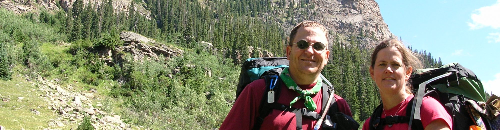

Backpackers: Ed Tucker, John Gundry, Mark Schedler, Carl Fisher
September 06, 2008 (10 miles) – The backpack trip started at Rainy Pass along the Bridger Creek trail and then along the McAlester Creek trail. We ended the day at McAlester Camp after doing 10 miles with 4.7 of that on the PCT. The last couple of miles were all uphill switchbacks. I was nursing a blister on my toe, making be concerned about my ability to complete the entire trip and as a result this last uphill took all my energy. The trail is mainly forested and the tread exceptionally good. The camp “toilet with a view” was in sight of another camp. My energy level increased following pumping water, setting up camp, and eating supper.
September 07, 2008 (10.4 miles) – Last night the temperature exceeded my sleeping bag rating (40 degrees) and I was cold to the point where I put on a shirt and almost put on my pants. Ed said the temp was 32 degrees and after we started hiking we saw frost. There was an immediate climb from the camp along the Rainbow Creek trail which then leveled out for several miles until Bench Creek camp where we had lunch.
Upon reflection at lunch I decided yesterday really was a tough day for me Not so much trail difficulty instead it was my attitude and blisters on my feet. I was even questioning why I was in the back country. Today, totally different! I’m wearing tennis shoes, blisters are not an issue and my energy level is high. The lunch break was relaxing helped gain back my energy. The cure for the blisters – moleskin on two toes, wearing toe socks with my tennis shoes.
After the lunch break the trail took an immediate downhill along Rainbow Lake trail to Rainbow Creek where it then turned uphill with many switchbacks for a 1000 foot elevation gain. The trail here is well maintained. About 1.5 miles from Rainbow Lake camp we made another 500 foot elevation gain – mainly through a large rock slide area. When looking back along the trail just traveled we had excellent views of the valley. We camped at Rainbow Lake camp with excellent views of Rainbow Lake.
September 08, 2008 (10.6 miles) – Today started with an immediate 500 foot elevation climb to the pass above Rainbow Lake. When we started the sun had just come up and there was no wind allowing us to take some awesome reflection pictures of the lake and mountains. The downhill was pretty severe – different than our map recon which led us to think it would be a gentle descent. We also encountered numerous downed trees across the trail which we began to count (final count 127). Many were small but some were challenging to get over and/or around.
We stopped and had lunch at South Fork Camp before heading uphill (nothing significant) when we headed West on the PCT. It was 3.7 miles to our destination but it sure felt like less to me. I had been pretty drained by lunch and took a good nap. The tread and elevation changes on the PCT make the walking easier and I changed into tennis shoes again. Took a nice break at Maple Creek where Mark video’ed me crossing. The camp tonight, North Fork, is the largest one we’ve been in yet. The weather has been perfect – sunny, 70 degrees during the day and 30 degrees during the night, and no rain.
September 09, 2008 (10 miles) – Left the gentle grade and smooth tread of the PCT after 2.9 miles and walked on an old road between Bridge Creek camp and Park Creek camp. At that point we got on the Park Creek Trail and went straight UP, at least it felt that way. Step, breath, step, breath, repeat 20 times then take a short rest. It was a tough 2 miles to reach 2 Mile Camp where we had lunch and did a river crossing on a log. From 2 Mile Camp to 5 Mile Camp (our destination for the night) the trail was up and down with low to moderately maintained trails. The stream by the camp, Park Creek, is full of silt and glacier bloom. The water is really cold, forcing cleaning up to be a very quick, frigid process.
September 10, 2008 (11 miles) – Overnight the temperature only fell to 45 degrees making for a warm, deep sleep. We hit the trail at 7:15 due to the miles we planned to do and the elevation gain (more than 3000 feet). The trail to Park Creek Pass was steep, narrow, and acceptably maintained. The views from the pass are simply awesome. After the pass we started an immediate downhill. From Thunder Basin hiker camp to Thunder Basin horse camp the trails were over grown with numerous low downs blocking the trail. We actually got off trail a couple of times, luckily finding our way back to the trail without incident. At one of the numerous stream crossings in a V cut gorge a rock gave way as I attempted to push off for the next rock and I fell – not into water – but onto large rocks and did a complete log roll with my pack still on. When I stopped rolling I was about 8 feet from where I started. Luckily my pack hit the rocks first to break my fall so my only problems are a small cut on my right elbow and a sore left elbow. Nothing a little Ibuprofin can’t handle. The downhill trail to Skagit Queen Camp is nicely graded with numerous switchbacks. However, the trail after that turned up, no more nice grade with switchbacks. Some really tough, straight up the hill trails. Finally arrived at Junction Camp at 5:00 pm to some nice campsites.
There are 2 mule deer stalking our camp. Last night they came into camp and one of them took Mark’s shirt that was on his tent to air out and started licking it. Mark realized what was happening, yelled and chased the deer who then dropped his shirt. It was 1/2 soaked in deer saliva so Mark had no choice but to freeze his hands and wash the shirt in Park Creek. We assume the deer was interested in the salt residue in Mark’s shirt.
September 11, 2008 (14 miles) – No notes were recorded during the day or after the trip ended for this day. That’s the way it happens some times. We just headed for the car. Actually we headed for Hwy 20 and then a short jaunt back to the trailhead where the car was parked.