What an awesome trip. Highlight of the trip was all of the wonderful scenery. The low light of the trip was all of the smoke from wild fires.
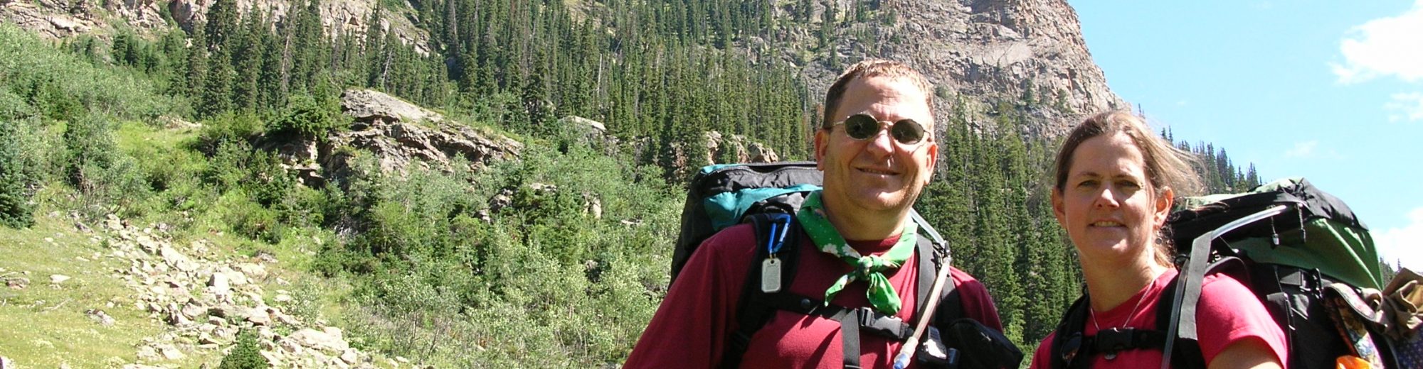
August 8-10, 2020 – John Gundry, Ed Tucker and Carl Fisher drove in Carl’s car from Green Bay, WI to Mammoth Lake, CA. One highlight of the drive was stopping at the Great Salt Flats in Utah.
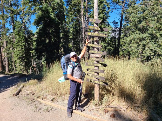
August 11, 2020 – Carl drove to Whitney Portal and was picked up by Mammoth Taxi for a ride back to the Quality Inn in Mammoth Lakes where they were staying. All went well. We celebrated with wine in our room in paper cups because the COVID rate in Mammoth Lakes was high.
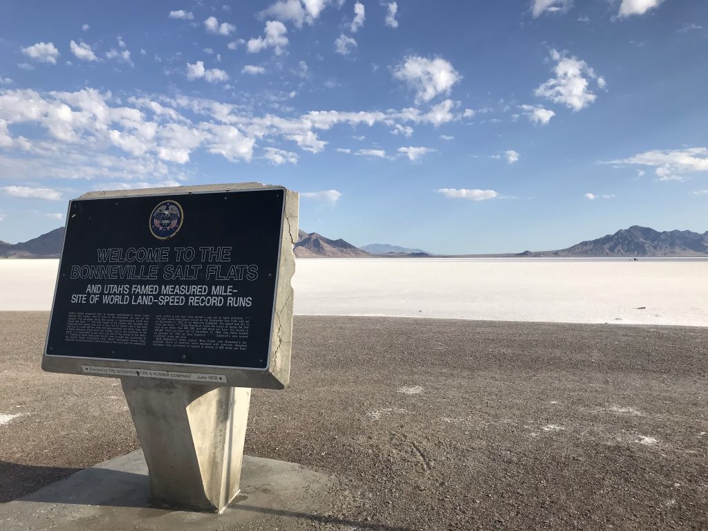
Bonneville Salt Flats 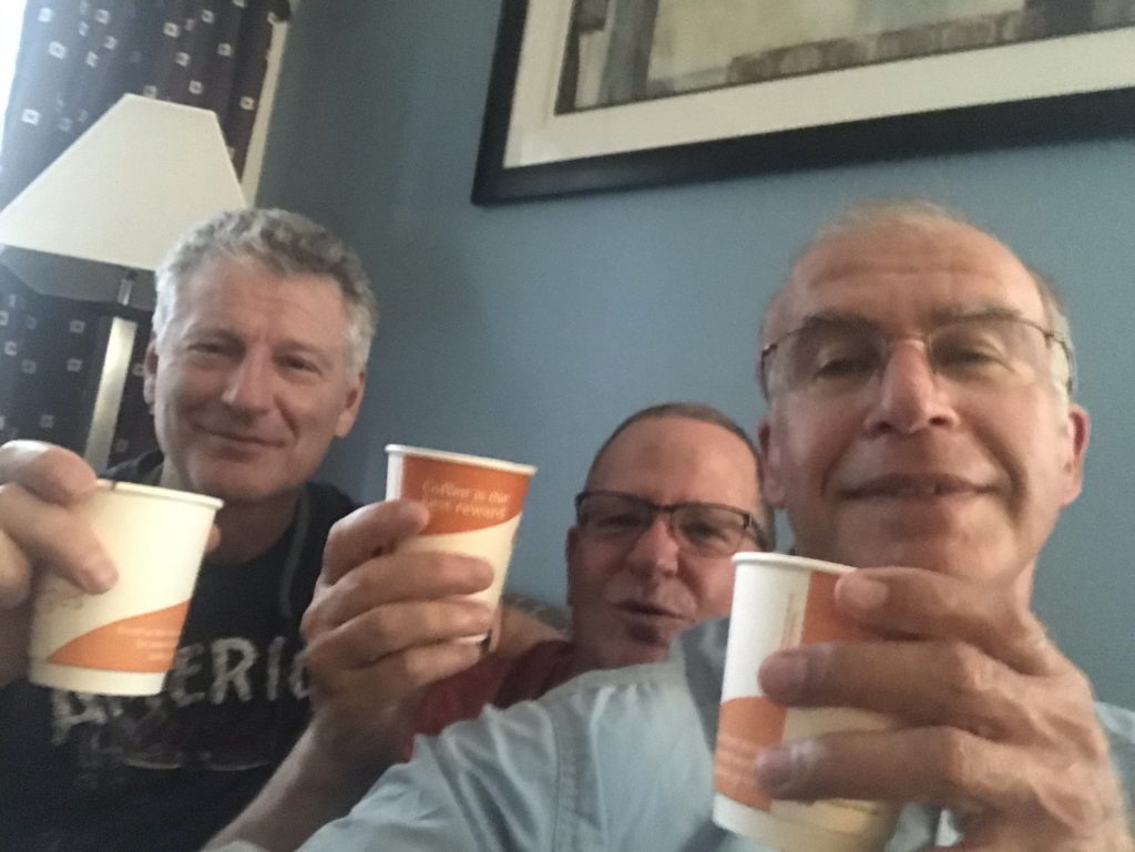
Toasting to the beginning of the trip with paper cups in our motel room.
August 12, 2020 – Miles: 6.5 Cumulative: 6.5 Camp Elevation: 9100
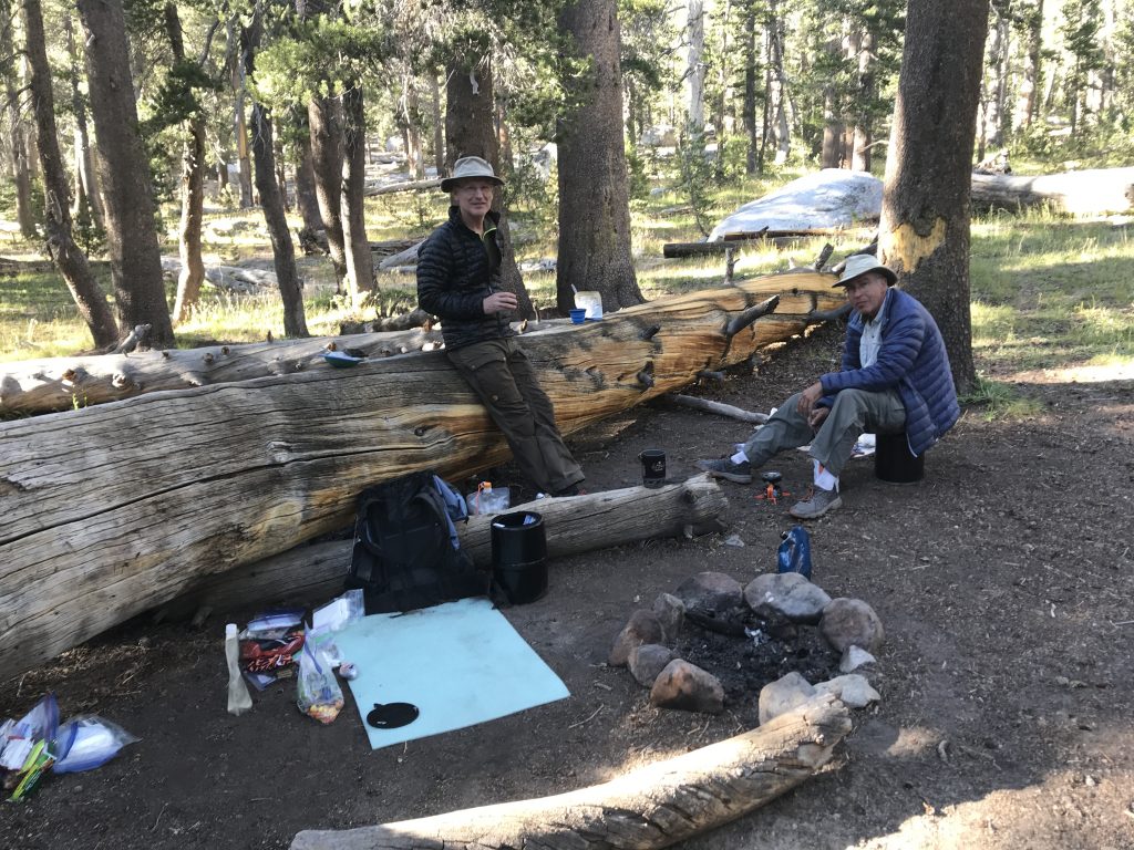
We were picked up by Mammoth Taxi at 9:00am and dropped at the trailhead at Red’s Meadows. We immediately got on the trail – the WRONG trail. It took us about ¼ mile before we realized we were actually heading the wrong direction and turned around. Finally found the right trail and headed out at 10:15. The trail was mainly uphill but not too hard. We got to our intended campsite at Deer Creek at 1:30 and decided not to press on to allow us to get better acclimated to the altitude. During the day we met a couple of guys taking a break so we stopped to talk with them. As it turned out one of them was from DePere, WI, a suburb of Green Bay, from where he graduated in 2007. Weather was almost perfect – sunny, no clouds, and temperatures in the 70’s. We camped near a mother, her daughter (college age) and a friend who gave us lots of info about the trail ahead (they were NOBO). They carried chairs and bourbon and were fun to talk with.
August 13, 2020 – Miles: 9.5 Cumulative Miles: 16.0 Camp Elevation: 10380
It was much colder last night than I thought it would be. Around 38 degrees but I hadn’t gotten my sleeping quilt properly adjusted so I tossed and turned all night long. I hit the trail at 7:00 with John and Ed starting at 7:30. The trail immediately went uphill for 5.3 miles with no water availability which presented no issues. We arrived at Purple Lake at 11:30 for lunch with only 2 miles left for the day. Our final destination was Lake Virginia to which we arrived at 1:30. We were the only ones camped at this beautiful location except for one lady that hiked in at 5:00 and camped far away from us. I was a bit dehydrated so I drank lots of water which, fortunately, only forced me out of the tent once during the night.
Camp at Lake Virginia 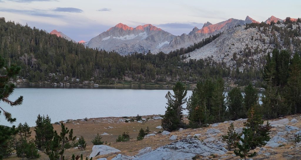
Setting sun on the mountains behind Lake Virginia
August 14, 2020 – Miles: 13.5 Cumulative Miles: 29.5 Camp Elevation: 7900
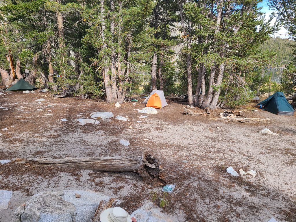
I turned 65 years old today. Last night was not as cold as the previous night. However, I prepared as though it would be cold again. Woke up at 10:30pm roasting so I had to spend time undoing some of my prep for cold temps. We hit the trail at 7:00 (this became our standard start time) and had lots of downhill followed by lots of uphill followed by lots of downhill. The trail took us through Silver Pass at 10,900 feet. We arrived at our planned camp early and decided to keep going to, hopefully, take miles off the day to John Muir Ranch where we are getting resupply. We are camping next to Mono Creek in 3 really nice tent sites.
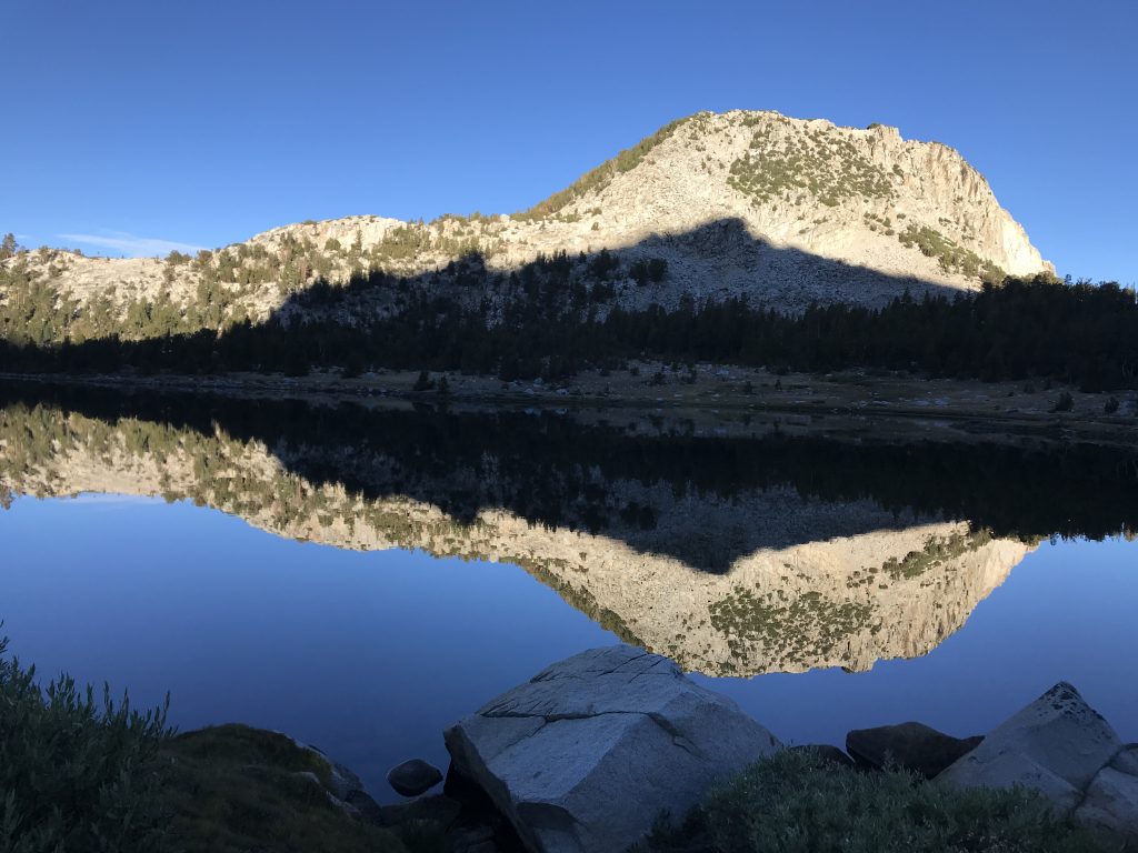
Morning reflection on Lake Virginia 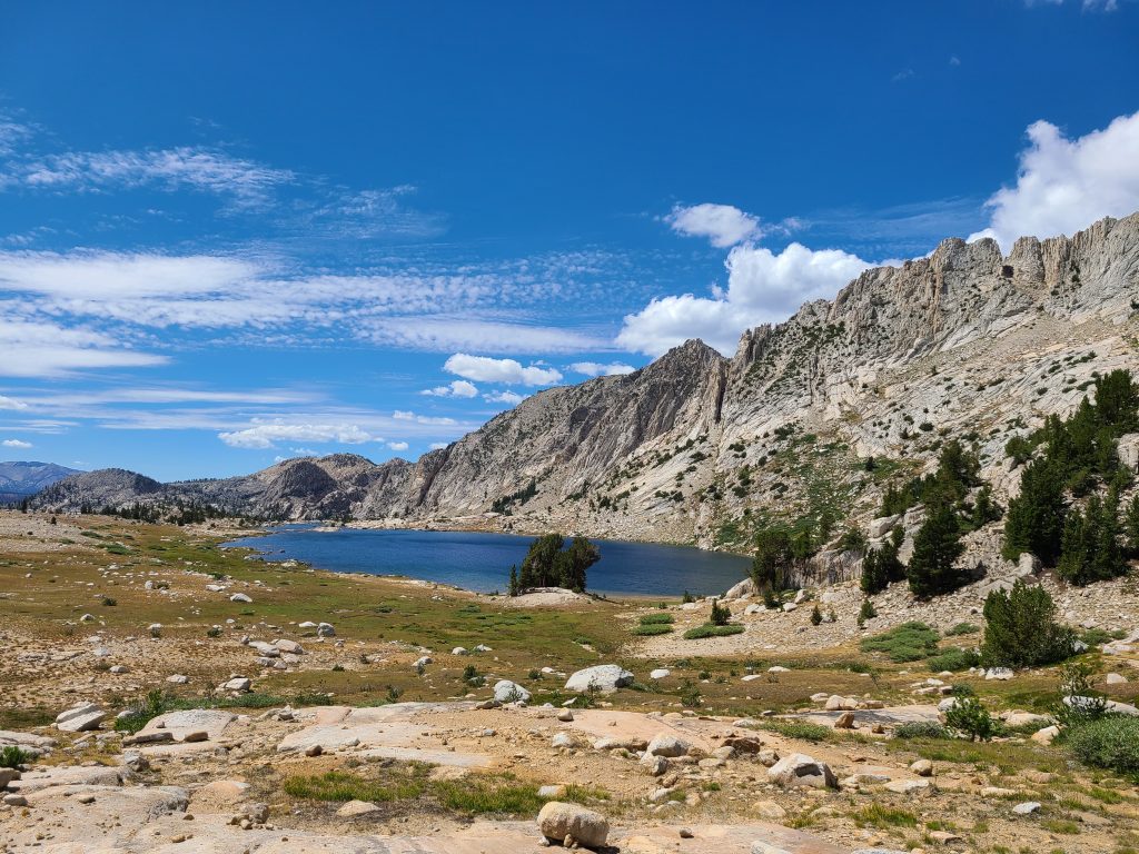
One of the many beautiful lakes we hiked by
August 15, 2020 – Miles: 11 Cumulative Miles: 40.5 Camp Elevation: 10010
The day started with a somewhat flat 1 mile stretch and then we climbed 2200 feet over about 3 miles. It was a tough climb. Then a bunch of downhill followed by the final 3 miles uphill. I was beat. The final mile was in a light afternoon rain with a bit of small hail thrown in for good measure. Fortunately it stopped long enough for us to get camp set up before it started raining hard enough to force us into our tents. Good time for a nap. Once the rain ended we had supper and then to bed at backpacker bedtime – 7:00 pm. The rain started again at about 9:00 for an hour while I was comfortably tucked in my sleeping bag in my tent.
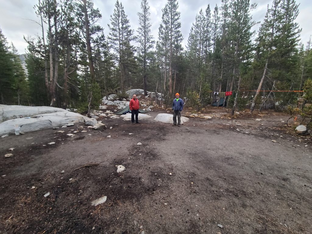
Hanging out at camp waiting for supper time. Carl Fisher and Ed Tucker 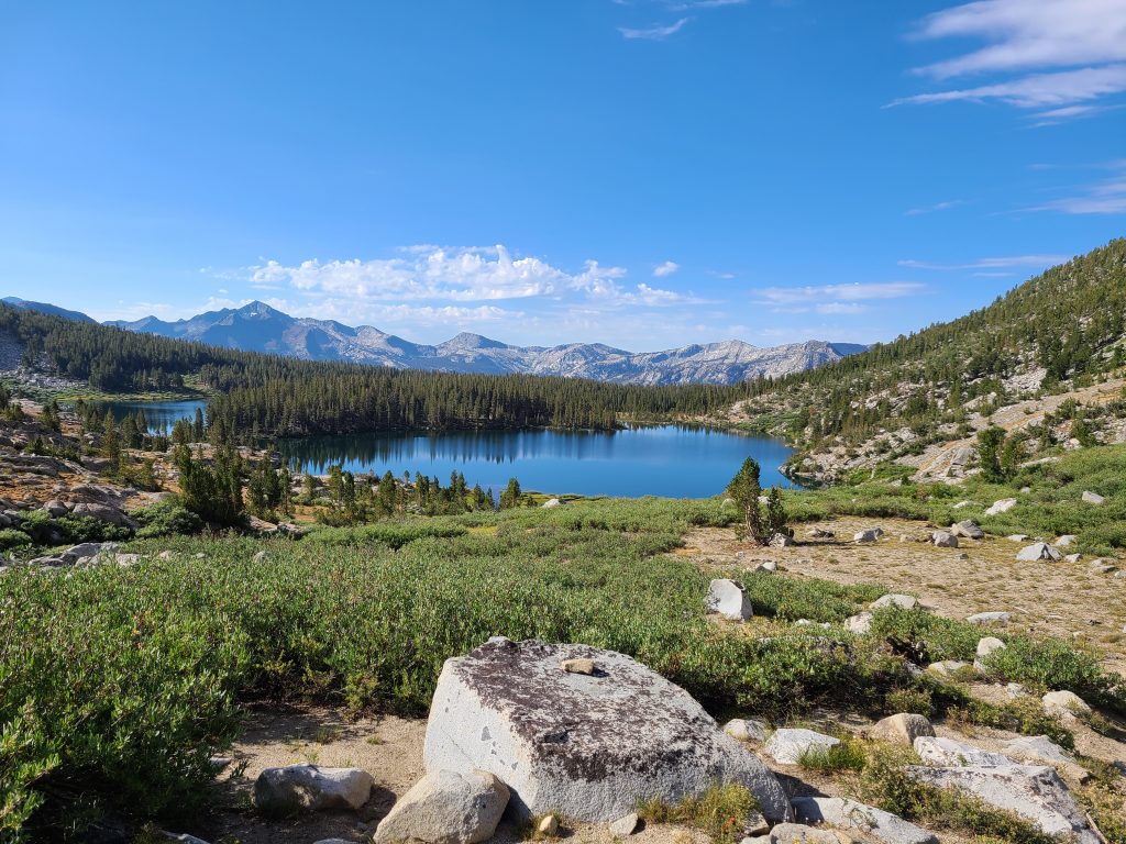
What a glorious day and picture!
August 16, 2020 – Miles: 10.5 Cumulative Miles: 51.0 Camp Elevation: 7777
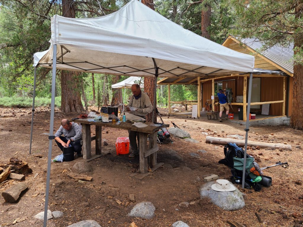
Hiking started at 7:00 (no surprise). John hikes faster than Ed or I so we gave him our spare batteries and power cords for him to hike ahead to John Muir Ranch where we were getting a resupply box and there is electricity to power us up. The first two or three miles of the trail were all uphill and then all downhill to the ranch. We passed by Marie Lake which is beautiful. The high point for the day was Selden Pass at 10,900 feet. The John Muir Ranch resupply point was no big deal. Our boxes arrived (to include the extra box we sent which we returned). We were socially distanced as we sorted our boxes and prepared for our heavier packs. Food is heavy even when dehydrated. Camp was less than a mile further down the trail. Thunderstorms threatened and light rain began just as we were preparing to start supper. Into the tents we went to wait it out. The best campsites were already taken so we had to set our tents up in a wash area where, if we had heavy rains, would flood. Fortunately we only had light rain for only a short period of time.
Resupply at John Muir Ranch. 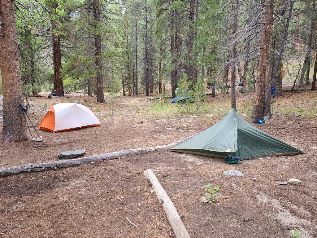
Hard to tell but if it had rained hard we would have been in a river. Only place available to camp!
August 17, 2020 – Miles: 11.3 Cumulative Miles: 62.3 Camp Elevation: 9876
The highlight of the day was the crossing of Evolution Creek which was flowing fast and about knee deep. I crossed with my shoes on with the inserts and socks removed. The water was pretty cold but the crossing caused us no issues. Just prior to Evolution Creek we ran into a group with 5 llamas. We got to watch them cross the creek. As we neared our camp for the night (about 2 miles out) the weather turned really nasty with high winds and threatening skies. We decided to hunker down and wait for the storm to pass. We only got a few drops of rain and then it started to clear a bit so we were able to make it to camp with no issues. Overnight disaster struck for me. My air mattress developed a leak and I ended up on the ground by morning. Since my air mattress is an important thermal layer between me and the ground when I sleep I ended up cold and sleepless for a large portion of the night.
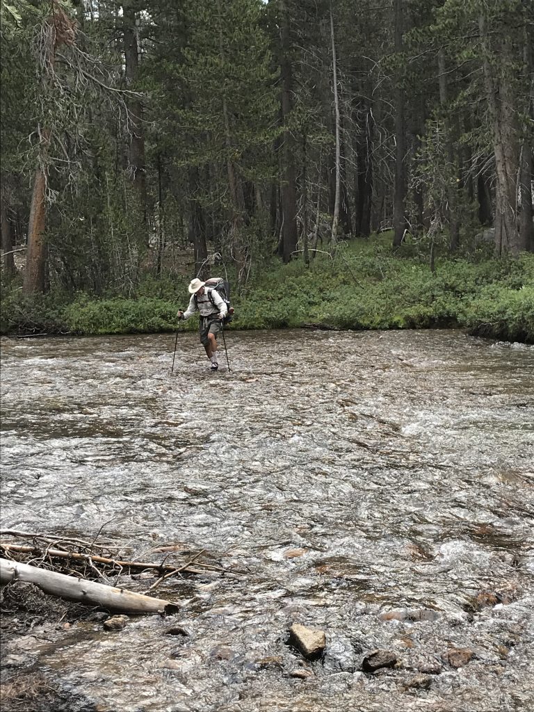
Ed Tucker crossing Evolution Creek. The only crossing the entire trip that got our feet wet. 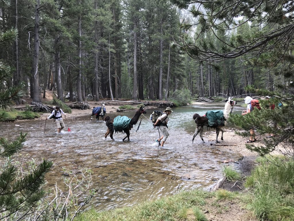
A pack train of Llamas crossed Evolution Creek at the same time we crossed.
August 18, 2020 – Miles: 11.4 Cumulative Miles: 73.7 Camp Elevation: 10488
Highlight for the day was going through Muir Pass and, at the pass, seeing Muir Hut made of stone. However, we paid to get there, doing eight miles uphill with 2000 feet elevation gain and very, very rocky trail. We made it to the pass at 12:15 and had lunch before starting the four rocky miles downhill to camp. We are in a very nice camp near a stream and we are the only ones here. Again afternoon clouds were threatening and sprinkles forced us to put on rain gear and to set up camp quickly. Just as camp was set up the rain got heavier forcing us to jump into the our respective tents. Air mattress is still losing air overnight. I wake up once or twice and pump it up. I carry a repair kit so during the day I tried to find the leak but was not successful. (After trip – in the motel room in a tub full of water I was able to find the small leak and repair it.)
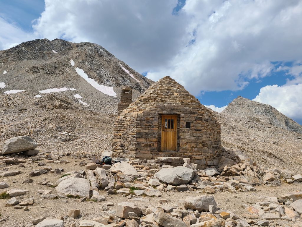
Muir Hut at the Muir Pass. Constructed in 1930 by the Sierra Club to honor John Muir 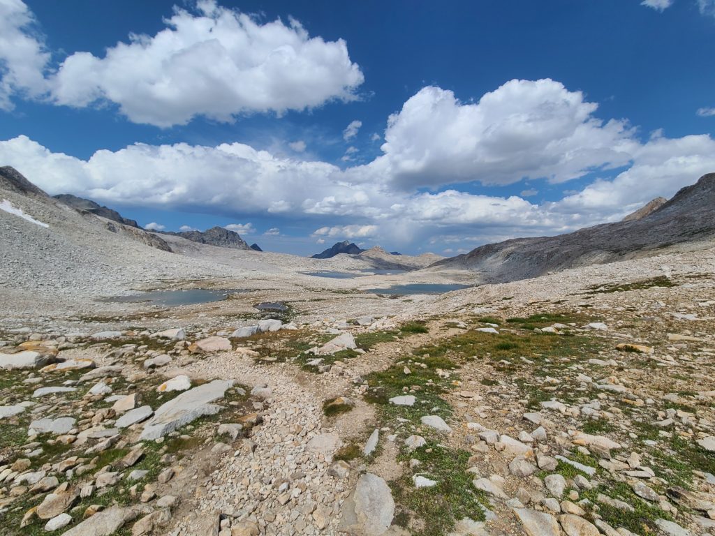
Looking back from where we had come as we approached Muir Pass. It was a lot more uphill than the picture shows.
August 19, 2020 – Miles: 11.8 Cumulative Miles: 85.5 Camp Elevation: 8916
There was nothing remarkable about today. The first 8 miles were all downhill and the last 4 uphill. We got into camp at 2:00, set up just in time for the afternoon rain which started at 2:45. The rain was light, nothing serious – excellent for napping. later I took a “bath” in the nearby stream and washed my hiking clothes which I’m hopeful will dry by morning (they did except the socks were a bit damp).
August 20, 2020 – Miles: 11.8 Cumulative Miles: 97.3 Camp Elevation: 10188
The highlight of the day was climbing the Golden Staircase to Mather Pass. It was 3300 feet up with lots and lots of stairs. The low light for the day was the smoke to which we woke up. Trail rumor says the smoke is caused by wildfires started by lightning strikes. The fires are both north and south of us but we have not seen or heard of any official trail closures, so we press on. Since we have no internet or cellular signals our only source of info is hikers traveling in the opposite direction. Historically we have found the trail rumors to be mostly factual. Got into camp around 4:00 and there was no afternoon thunderstorm for which we were thankful.
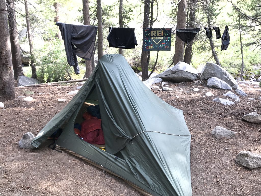
Most nights in camp at least some of our clothing got washed. 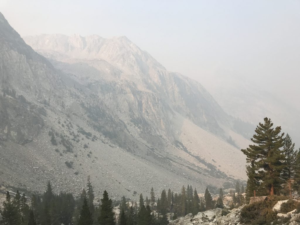
Smoke from wildfires hanging in the valleys. Not fun to breath while walking and climbing
August 21, 2020 – Miles: 12.1 Cumulative Miles: 109.4 Camp Elevation: 8546
The highlight of the day was going over Pinchot Pass (at 12,130 feet) which was actually not all that hard, about 2000 feet up. The second highlight was hanging around camp at the suspension bridge talking to other hikers. After a couple of drinks (I carry grain alcohol and mix with blackberry flavored Mio and water, John uses Bacardi 151 which he mixes with water) we walked around to other campsites (staying socially distanced) and talked backpacking and gear.
August 22, 2020 – Miles: 0.0 Cumulative Miles: 109.4 Camp Elevation: 8546
Today is a zero day which means we are not doing any backpacking, just resting and allowing our bodies to recover. We got our resupply boxes around 2:00pm which means we will have heavy packs again tomorrow. The boxes were brought in by mule. No rain.
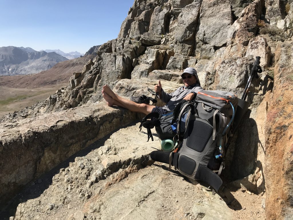
Carl relaxing at Pinchot Pass 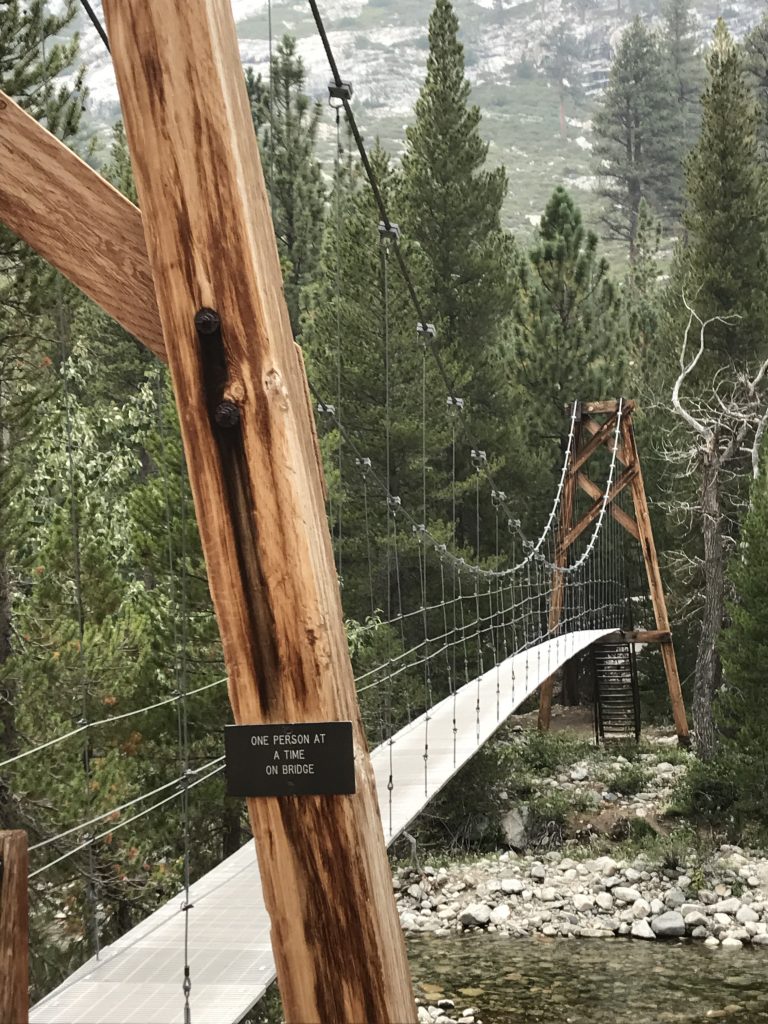
The suspension bridge was eerie to cross. With practice it got less scary.
August 23, 2020 – Miles: 6.9 Cumulative Miles: 116.3 Camp Elevation: 10553
A very easy day. 2000 foot uphill with decent tread to Rae Lakes area. We arrived at our intended camp area at 11:00 under blistering sun. The best sites for our tents is in the sun so we chose to find nearby trees and relax in the shade until storm clouds started gathering. We set-up our tents just in time to use them as shelter from a light afternoon rain. There is lots of beauty in the clouds and the mountains at this location.
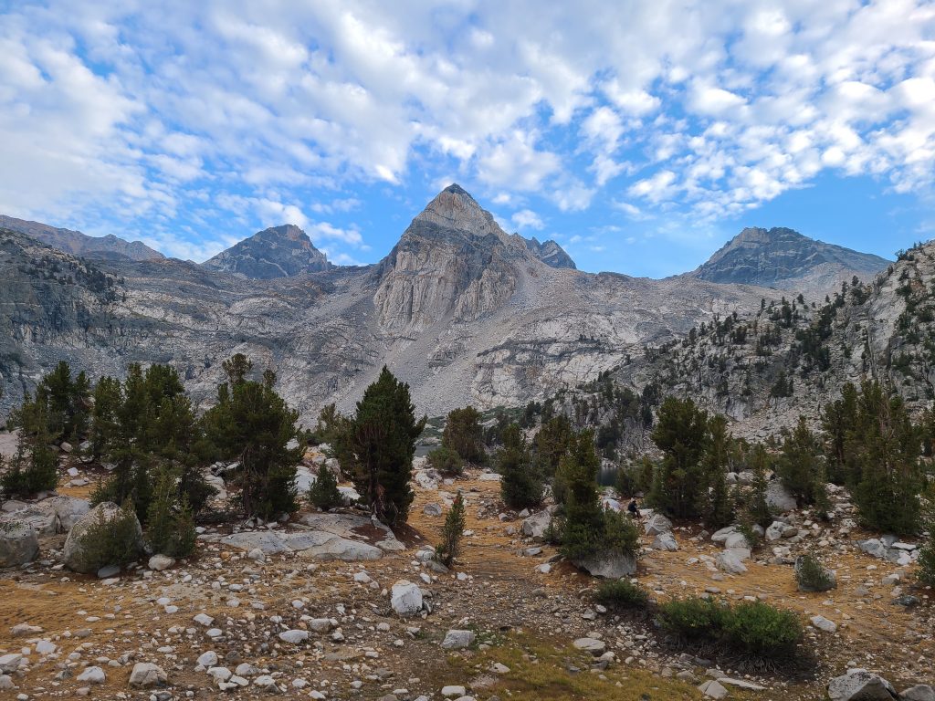
Looking south from our campsite at Rea Lakes 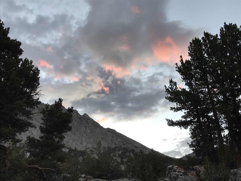
Sunset light on the clouds at Rae Lakes
August 24, 2020 – Miles: 9.1 Cumulative Miles: 125.4 Camp Elevation: 10488
Highlight of the day is going up and over Glen Pass. There are lots, and I mean lots, of switchbacks making for reasonable climbing and we made it up the 2000 feet without a lot of pain – although lots of huffing and puffing. Ed is hopeful at each pass to get cell service to let our wives know we are safe. He checked again at Glen Pass and like all the others – no cell service. Next we had 3500 feet down and again not too bad. When we got to the low point for the day – about 9500 feet elevation – wood smoke and ash started rolling in. The amount of ash reminded us of a light snow in late fall or early winter in Green Bay, WI. However, the smell was anything but delightful. Ed and I wore our bandanas as masks for the final three uphill miles. It was slow going because we didn’t want to breath too hard and suck ash deep into our lungs. We camped at a location that set us up nicely to cross Forrester Pass at 13,000 feet, and the highest point on the PCT. I started to feel a tightness in my chest from the smoke and wore my mask all evening and in my tent until about midnight. Even the close in ridges are not visible through all of the smoke.
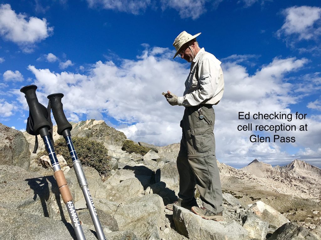
Ed checked for cell reception at every pass. No luck at any of them. 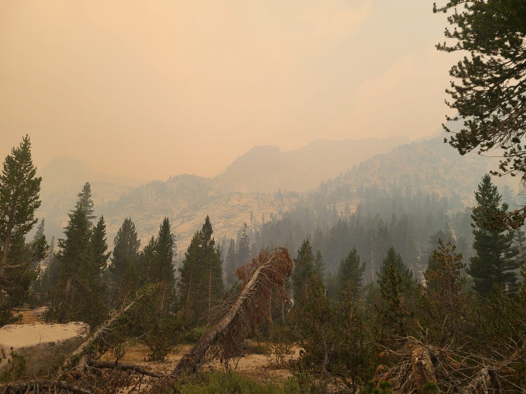
Smoke filled valley that forced Carl off the trail
August 25, 2020 – Miles: 12 Cumulative Miles: 137.4 Camp Elevation: Hotel
When we woke this morning it was reasonably clear. A fellow hiker that camped with us last night came in from a trailhead that is 5 miles back down the trail and then 7 miles over Kearsarge Pass to the trailhead. He felt confident that I would be able to thumb a ride into town. I have decided to not take any chances and to bale. Ed and John have decided to continue on. The climb to Kearsarge Pass was tough with few switchbacks – meaning lots of straight up the hill trail. I got to the trailhead at 2:30 and while on the trail had no luck securing a ride. Fortunately for me there was a hotel shuttle picking folks up at 3:00. The shuttle had room for 5 and only 4 were reserved so “Lone Pine Kurt” (the shuttle driver) said he’d give me a ride. We never talked about price. When we got to the motel in Independence CA I pulled him aside and said, “I’d really like to get to Lone Pine CA. Can you help me out.” He responded, “Sure, that’s where I live.” It was my lucky day. Then on the ride to Lone Pine (about 20 miles) I mentioned to Kurt that I really, really wanted to get to Whitney Portal (another 15 miles) as that was where my car was parked. He said, “No problem! That’s where my next pickup is.” I couldn’t have been happier and was willing to pay whatever he charged. He is retired military as am I and so when I asked him how much I owed he said zero. He was going that way anyway. I pulled out my wallet and asked if $40 was enough? My car was in good shape and immediately started. I drove to a motel in Lone Pine and was comfortably in my room by 5:00pm – a mere 2.5 hours after coming off the trail with no idea how I was going to get a ride. All in all, it was a great way to end being forced off the trail.
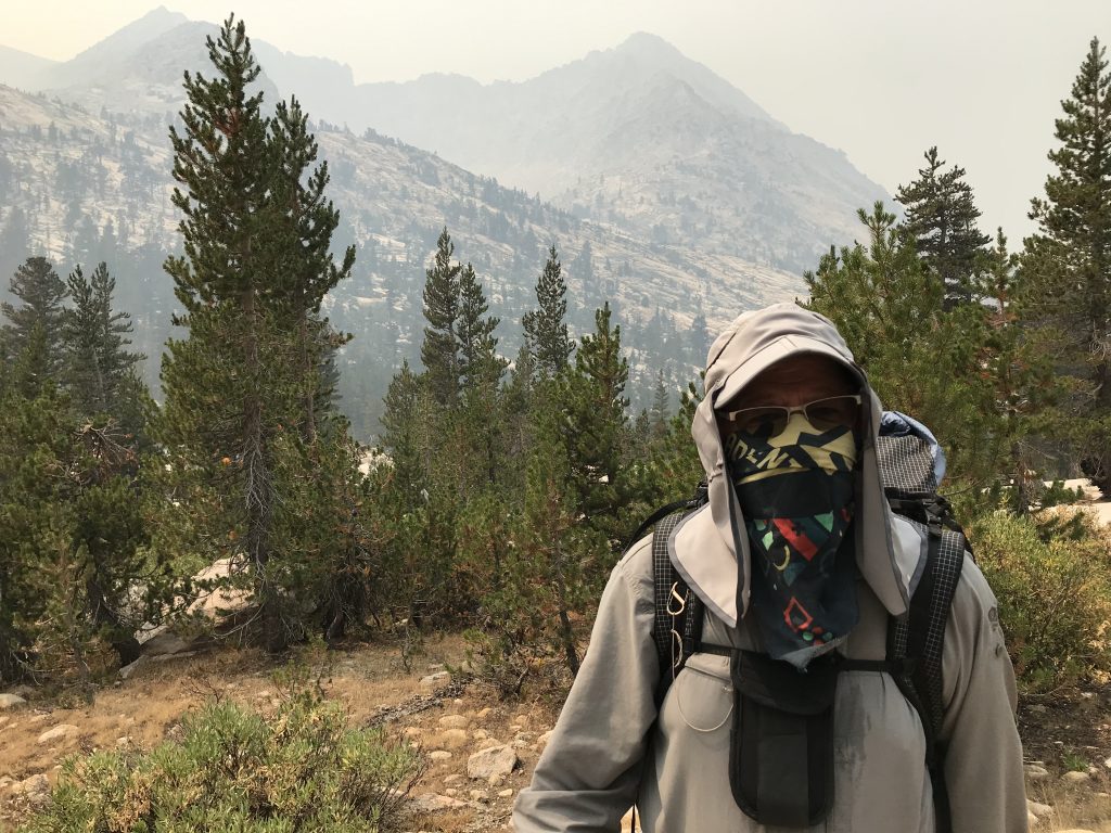
Smoke was so thick that we were forced to wear our bandanas as masks. It really helped. 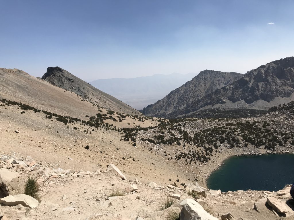
The view from Kearsarge Pass looking towards the trailhead about 7 miles away that Carl was shooting for.